Storm Alex: 'Tornado' pictured in skyline above Worthing
and live on Freeview channel 276
Karen Taylor was driving into town on Saturday (October 3) when she spotted the swirling cloud mass in the distance and pulled over to take some pictures.
Despite a spot of storm chasing to find the source, Karen said the 'beautiful' cloud formation faded away soon after.
Advertisement
Hide AdAdvertisement
Hide AdRather than a tornado, what these pictures show is a funnel cloud - a precursor to a tornado.
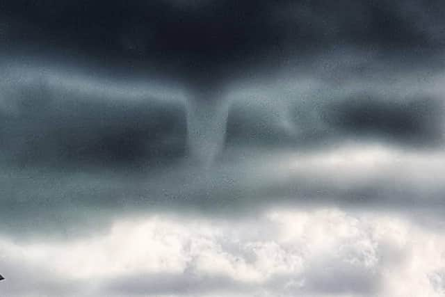

The funnel shaped cloud is formed of condensed water droplets being tossed in a rotating column of wind from the base of a cloud, typically cumulonimbus clouds.
Funnel clouds differ to the more destructive tornadoes in that they do not reach the ground, but rather remain in the air.
A tornado is in contact with both the Earth and the cloud from whence it came.